
Simsbury Neighbors, Block Sources
A useful Simsbury block question begins with a clear claim. MapXpress shows land shapes and layers. The Assessor connects a parcel to a tax-record-associated name and property fields. The Town street list fixes a number to a published range, postal key, voting district, and grid section. The voter route concerns registration status under state rules, not a household count. Civic plans and minutes can name groups or public participants, while older directories, maps, and newspapers can help reconstruct a past block. Those sources do not describe the same people, so a neighbor search needs an evidence trail rather than one blended list.
| Source | What It Shows About a Block | Access |
|---|---|---|
| Simsbury MapXpress GIS | Parcel outlines, adjacent polygons, assessor grid, aerial, zoning, flood, voting, historic, and public-property layers. | Public viewer with manual click or select; no inspected neighbor table, radius tool, or buffer tool. |
| Simsbury Assessor Property Record Cards | Tax-associated parcel name and property traits, with owner, street, number, unit, MBL, unique ID, use, and condominium searches. | Online search; the Town stopped creating abutters lists in 2018. |
| Simsbury street list | Number ranges, S, T, W, and WS postal keys, ZIP labels, voting district, grid, and road marks. | Current public PDF; exact number matters. |
| Voter route | Registration and status fields allowed under Connecticut rules. | Registrar and SOTS routes; the public form was unavailable, so no block roster is asserted. |
| Simsbury civic plans and minutes | Named associations, roads, projects, public officials, petitioners, and meeting matters. | Agenda and board systems; no current membership roster located. |
| Simsbury historical collections | Past address labels, households, structure use, obituaries, and civic context. | Libraries, archives, deeds, maps, and newspapers; no verified local criss-cross run located. |
The table also shows why a current block result is limited. An owner field may reflect title or tax mailing data, not occupancy. A voter entry may be protected, inactive, or absent because of list maintenance. A civic reference can show that a group held an event without naming its members. Treat each line as a separate lead and record its date and source.
Simsbury Neighbor Lookup: Map a Block
The strongest current method for a Simsbury address starts with one known location and moves outward by parcel. It does not ask a map to produce a finished household directory. It asks the viewer to show which polygons touch, then sends each name or title question to the right custodian.
- Check the street name and number against the Town street list, including the published postal key and number range.
- Open the direct MapXpress viewer and use Search, zoom, pan, or map navigation to locate the target parcel.
- Turn on parcels, Assessor Grid, Parcel Information, and a useful aerial layer before comparing the surrounding shapes.
- Select the target, click each adjacent polygon, and record a parcel ID or owner field only when the selected card displays it.
- Verify title through RECORDhub and the Town Clerk land-record route, then verify a legal boundary with the deed or a survey.
The result is an address-to-parcel-to-adjacent-parcel trail. For a whole named road, the Simsbury street directory supplies the broader by-address workflow, while the block method stays focused on the lots immediately around the starting point.
Note: Adjacent parcels show a spatial relationship, not a household boundary or a complete list of people connected to the road.
Simsbury Neighbor Records and GIS
Simsbury MapXpress gives the block method its spatial frame. The viewer includes Search, Select, Parcel Information, pan and zoom, extent controls, Print Map, Legend, and simple, path, and area measurement tools. A researcher can use the Assessor Grid to keep a parcel reference in view while checking the map.
Relevant layers include parcels, the 2023, 2021, 2019, 2016, and 2012 Connecticut color aerials, zoning, voting districts and polling locations, historic and architectural inventory, wetlands, FEMA flood mapping, open space, town-owned properties, and other environmental or public-property layers. These layers add context. They do not identify every person on a lot.
An indexed GIS description reports about 10,610 parcels, annual parcel-map updates, and daily ownership-data updates. The live indexed search endpoint was unavailable during inspection, so fields described for the portal, including property name, house number, street, parcel ID, and unique ID, should be treated as a documented route rather than a saved result.
- Parcel
- A mapped land unit shown as a polygon, with an identifier and possible property information.
- Assessor Grid
- A map reference layer that helps compare parcel position and local map context.
- Tax-associated name
- A name tied to assessment or property records, not proof of who occupies a home.
- Adjacent polygon
- A mapped parcel that touches the target shape; title and legal boundary still require source verification.
Map limit. The viewer warns that its information may not be current and is not legal evidence. Use it for discovery, then confirm title with a deed or survey.
Simsbury Neighbor Records and Voting
The Assessor portal is useful for narrowing a parcel, but its fields need a careful reading. Search controls expose owner name, street, number, unit, MBL, unique ID, property use, condominium complex, and related property criteria. A result named “Name” is associated with the tax record. It is not an occupant field and it is not a list of everyone in a household.
Simsbury states that the Assessor stopped creating abutters lists on February 12, 2018. That change matters because touching parcels must now be checked through the map and then verified one parcel at a time. A street number from a range, a parcel polygon, and a tax name can identify the next research step, but they do not create a ready-made list of nearby people.
Simsbury postal and voting geography add a second check. The street list uses S 06070 for Simsbury, T 06081 for Tariffville, W 06089 for Weatogue, and WS 06092 for West Simsbury. The letters are postal keys, not separate municipalities. Voting district is a separate field.
- District 1, Henry James Memorial School.
- District 2, Latimer Lane School in Weatogue.
- District 3, Tootin' Hills School in West Simsbury.
- District 4, Tariffville School.
The Simsbury Registrar route and the Connecticut Secretary of the State lookup are the official election paths, but the public lookup form was blocked during inspection. The full-file request is a separate route: the official voter-file request form lists a $300 payment, CSV output, and legal-use certification, with use limited to election, scholarly, journalistic, political, or governmental purposes. It is not a shortcut to a nearby-address roster.
Note: A polling location helps verify address geography, but it does not identify every person connected with a block.
Simsbury Neighbor Groups and Records
Simsbury community records can explain how a block is organized without exposing a private member list. The 2025 Tariffville Neighborhood Plan and Simsbury minutes from 2011 and 2012 refer to the Tariffville Village Association and community events. No public membership directory or current join page was located. The Pine Hill material is similarly useful for neighborhood history, not for naming households.
A 2022 Selectmen memo describes roughly 40 homes on Pine Hill Road, Woods Lane, Stebbins Brook, and South Road, with private-road maintenance handled through an HOA. It says the Pine Hill HOA was established in March 1975 and connects the subdivision to Ensign Bickford. The memo does not provide a public member or contact roster.
The Town's Agenda Center can help trace public meetings, dates, categories, officials, petitioners, and named civic matters. The Board and Committee Information System, the Planning and Conservation records, and the Plan of Conservation and Development, adopted January 1, 2024, offer public civic-name trails, not association membership lists.
The Agenda Center image gives a visual cue for the kind of public civic record that can connect a road or project to a date. It should be read as a meeting source, not as evidence that every nearby household took part.
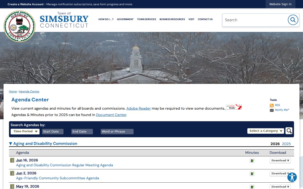
Public minutes can support a narrow civic question while leaving private association membership unknown.
| Civic Route | Local Evidence | Access Boundary |
|---|---|---|
| Tariffville Village Association | 2025 neighborhood planning and 2011/2012 meeting references. | No public membership directory or current join page located. |
| Pine Hill HOA | Road history, private maintenance, March 1975 origin, and Ensign Bickford subdivision context. | No public member or contact roster located. |
| Agenda Center | Public meeting dates, categories, officials, petitioners, and civic matters. | Public agenda trail, not a neighborhood list. |
| Boards, committees, and POCD | Public names, terms, planning topics, and community priorities. | Official civic information, not association membership. |
Note: Civic minutes can name a public participant while leaving association membership and private contact details outside the record.
Historical Simsbury Neighbors
Past blocks need a different method. There is no verified continuous Simsbury criss-cross directory run, so an address-first search should use the label printed in the source era, then compare directory citations, maps, deeds, and local news. A record may say Simsbury, Weatogue, Tariffville, or West Simsbury even when a current form uses the Town's present address key.
The Simsbury Free Library Quarterly name index covers 1994 through Summer 2022 and can move a street clue into a person or article search. The MS025 local newspaper collection covers 1941 through 2018. The Historical Resources Inventory and the Town's historic and architectural material cite Sanborn references from 1923 and 1940. These sources can add a past owner, structure use, obituary, or civic event, but an old mention is not proof of continuous occupancy.
Historical block trail: address-era label → directory citation or map → name variant → deed, obituary, newspaper, or archive confirmation.
For a title question, the Town Clerk land-record route remains the right check. For a household-history question, pair the deed with the library indexes, newspaper files, obituaries, and the historic inventory. Keep the source year beside every name so past residents are not mistaken for current neighbors.
Simsbury Neighbors, Tool Choices
Official Simsbury records and generic commercial neighbor tools serve different purposes. Local custodians expose a defined record type, such as a parcel shape, a tax-associated name, a voting status, or a public meeting. A commercial tool may combine public records and other data, but coverage, freshness, identity matching, and removal steps vary. Neither category should be treated as a complete household list.
| Question | Official Simsbury or Connecticut Source | Commercial Neighbor Tool Category |
|---|---|---|
| How is the area defined? | MapXpress parcels, Assessor fields, and the Town street list use a local address or mapped property. | May assemble a result through vendor matching and mixed source data. |
| What does a name mean? | It can be tax-associated, voter-related, a public participant, or a historical mention, depending on the record. | May collate names without showing the original record context or date. |
| How is it verified? | Use the deed, survey, registrar, or named custodian for the specific claim. | Coverage and identity matching can vary, so a result needs independent checking. |
| What about privacy? | State privacy programs, protected records, and FOI exemptions limit what may be released. | Removal and correction processes vary; do not republish sensitive details from a copied record. |
The local route is slower when a question crosses record types, but it leaves a clearer trail. It also makes gaps visible, such as an unavailable voter form or a missing association roster.
Privacy for Simsbury Neighbors
Simsbury privacy limits apply even when a name or address appears in a public system. Connecticut's Voter Registry Privacy Program under CGS §9-50(d) can restrict official voter-registry disclosure when a person swears that release would endanger the person or family. The Address Confidentiality Program, also called Safe at Home, gives qualifying participants a substitute mailing address. Neither program promises that every deed, assessor, court, newspaper, or commercial record will disappear.
Current voter guidance also treats birth year differently from month and day. Public Act 26-1 §96 makes only birth year public in the stated rule, while month and day are exempt. A protected voter, an inactive record, a list-maintenance delay, or an Address Confidentiality Program record can produce no result. No-result is not proof of nonresidence.
Lawful use. Keep block research to a specific personal, genealogy, property, or civic purpose. Do not use a parcel, voter, meeting, or archive reference to stalk, harass, threaten, intimidate, or expose someone. Do not republish exact sensitive addresses, phone numbers, dates of birth, or a vulnerable person's location.
A Connecticut FOI request seeks an existing, non-exempt record. It does not require the Town to create a list of neighbors, infer occupants, or merge separate databases. When a request is needed, identify the record, date, office, and narrow purpose, then use the custodian's stated channel and follow its privacy limits.