
Simsbury Sources for Previous Residents
A past household is usually reconstructed from separate trails. The Assessor and GIS can turn a current street address into a parcel and a tax-associated name. The Town Clerk and RECORDhub can carry a recorded title chain. Directories, census schedules, newspapers, obituary indexes, and house inventories can add people and dates. None of those sources is a complete list of everyone connected with an address, and the local directory evidence is discontinuous.
| Source | Years It Covers | Where Held | What It Shows |
|---|---|---|---|
| Town Clerk land records and RECORDhub | Online material observed from 1976; older office route | Simsbury Town Clerk and RECORDhub | Grantor, grantee, instrument trail, legal description, and images when access permits |
| Sanborn fire-insurance maps | 1923 and 1940 | Official historic inventory and library/map collections | Building footprint, use, nearby streets, and structure context |
| Local printed directories | 1913, 1915, 1917, 1928, 1932 | Historic inventory citations and local library/archive routes | Discrete name, address, and telephone-style clues |
| Connecticut Forest Service directory-style item | 1934 | Connecticut State Library digital collection | District, name and address, and telephone columns; OCR pairing caution |
| Local newspapers, MS025 | 1941-2018 | Simsbury Free Library finding aid and archive | Obituaries, civic notices, address clues, and household references |
| Simsbury Free Library Quarterly index | March 1994-Summer 2022 | Free Library online index | Name, date, issue, page, article description, and subject, not an address roster |
| Federal census | 1790-1950 | National Archives and local library access | Households by enumeration, subject to the 72-year release rule |
| Building permit records | Historical starting year not located | Building Department and CitySquared | Address, work, inspections, and close-date fields; no public result index located |
Choose the starting source by the question and date. A deed answers a title question. A directory or census may place a household at an address. A Sanborn map dates a structure. A newspaper or obituary can connect a name to an event. The best trail keeps those claims separate before bringing them together.
Simsbury Past Resident Parcels
Start with the address, not with an unverified person match. The Simsbury Property Record Cards portal accepts Property Use, Owner Name, location number, street name, unit, MBL, Unique Identifier, and Condominium Complex. Its result columns include Street Name, Number, Unit, Name, Uniqueid, MBL, Property Use, Acres, Zone, Buildings, and Condo Complex. The Name field is associated with the assessment record. It is not labeled as a current resident or occupant field.
MapXpress GIS adds a spatial check. Its direct viewer offers Search, Select, Parcel Information, aerial layers, Assessor Grid, historic and architectural layers, zoning, voting, environmental, and public-property layers. A target parcel can be compared with adjacent polygons, but the viewer has no inspected neighbor table or radius result. The Town warns that GIS information may not be current and is not for legal use. Use the parcel and MBL as a bridge to the deed, not as the chain of title.
Address key: Keep the number, street, unit, MBL, Unique Identifier, source date, and postal label in one note. That record gives older names a stable property clue without pretending that every person tied to the parcel lived there.
Simsbury Past Resident Deed Chain
Hartford County is the geographic county, not a route to a county clerk. Connecticut has no county seats, and county government ended in 1960. Land records for Simsbury are held locally by the Town Clerk. The Town Clerk's land-record page sends users to the blue RECORDhub link, then Search Sites, then Simsbury. The portal distinguishes complimentary index view and print from land-record access that includes images. An account is required, and image access is tied to the portal's subscription plan.
Search the current grantee, then read the prior grantor and move backward. Keep the recording date, execution date, book and page or instrument number, legal description, consideration or conveyance-tax clue, easements, restrictions, and corrective instruments together. A deed holder can be a prior owner without being a prior resident, so the title chain must later be paired with a household source.
- Use the Assessor Property Record Cards and GIS to confirm the street number, parcel, MBL, Unique Identifier, and current tax-associated name.
- Search that name as the current grantee in the Simsbury RECORDhub site and separate the complimentary index from image access.
- Open the deed image when available and copy the legal description, recording date, book-page or instrument reference, and named grantor.
- Search the prior grantor as an earlier grantee, then repeat the same comparison for each older instrument.
- When the chain reaches before the online coverage observation, ask the Town Clerk about vault retrieval, scanning, emailing, or in-office review.
- Compare each owner interval with a directory, census, newspaper, or house-history source before calling that person a past resident.
- Grantor and grantee
- The grantor transfers an interest. The grantee receives the interest. Searching the wrong side of the transaction can hide the prior link.
- Chain of title
- The connected sequence of recorded transfers that leads from an earlier instrument to the present title record.
- Legal description
- The deed's property description, such as a map, lot, bounds, or other identifying text. It can remain useful when a street number or name changes.
Simsbury Past Resident Deed Search
Town material from 2021 described online land-record indexes and images reaching back to 1976. That is an observed online-coverage note, not a guarantee that every page or image is present. Earlier deeds generally require the Town Clerk's vault or office route. A person at the counter, on the phone, by mail, or by a defined email request can help identify the correct older record. A request should name the property, date range, instrument type if known, and the legal description or map clue.
The recording-fee page states that current Town fees took effect July 1, 2025 under PA 25-168. The exact document type controls the fee, and copy or certified-copy charges differ from recording charges. Verify the current amount with the Town Clerk before sending payment. The office also publishes an unlawful restrictive-covenant notice and states that staff are not attorneys. A fee page can guide access, but it does not turn a deed index into a resident list.
Older-record tip. If a Simsbury deed is earlier than the observed online range, preserve the break and ask the Town Clerk for the vault or office route instead of extending the online index by assumption.
The Simsbury Town Clerk land-record search instructions explain the local route, while the Assessor, GIS, libraries, and Historical Society provide the supporting channels for an address history.
Simsbury Directory Years for Past Residents
The official historic inventory cites the Hartford Little Suburban Directory in 1913 and 1915, and the Farmington Valley Directory in 1917, 1928, and 1932. These are exact, separate years. There is no verified continuous Simsbury criss-cross run, and a missing year cannot be filled with a guessed entry. The 1934 Connecticut State Library item has a local Simsbury heading and district, name-and-address, and telephone columns, but OCR row alignment is unreliable. Do not assert a name-to-address or name-to-phone pairing without the scan.
The collections themselves are described in the Simsbury city directory collection record. For a previous-resident search, the printed volume is only one stop. Copy the source-era town or village label, the exact street spelling, and the page, then compare the result with a deed, census, obituary, or house inventory. A directory mention supports a dated lead; it does not prove title or current presence.
Simsbury Past Resident Address Labels
Four postal keys appear in the Town street-list legend: 06070 for Simsbury, 06081 for Tariffville, 06089 for Weatogue, and 06092 for West Simsbury. Tariffville, Weatogue, and West Simsbury are postal or village labels inside one incorporated town, not separate municipalities. Keep legal municipality, postal city, ZIP, voting district, and parcel identifier in separate fields.
Hopmeadow Street shows why the street number matters. The published list splits address ranges, with some ranges keyed W and others S. A street-only search can therefore put the wrong postal label on an old record. Historical directories may say Simsbury, Weatogue, Tariffville, or West Simsbury in ways that do not match a current form. No official ZIP realignment history or street-renumbering year was located. Preserve the source-era form, then compare the street list, USPS route, Sanborn map, legal description, and current parcel.
Simsbury Previous Residents Newspaper Trail
The Simsbury Free Library's local papers finding aid, MS025, covers 1941-2018 across 11 titles. It can supply an obituary date, civic notice, family reference, move, sale, or address clue that a deed does not show. The archive route asks for the collection name and row, with an email to simsburyfreelibrary@gmail.com using ARCHIVE REQUEST in the subject. Expect missing issues, OCR limits, and spelling variants. Read the original item when possible.
The Free Library also keeps a marriage index circa 1849-1877, a death index circa 1847-1892, and obituary abstracts circa 1922-2006. Its Quarterly every-name index runs from March 1994 through Summer 2022 and exposes Person Name, Date, Volume, Issue, Page Number, Article Description, and Subject. The useful sequence is name, date and issue, page, original article, then corroboration. An index hit is a research lead, not proof that a person lived at a particular address.
The Simsbury Free Library Quarterly name index shows the fields needed to move from a name to the issue that contains the context.
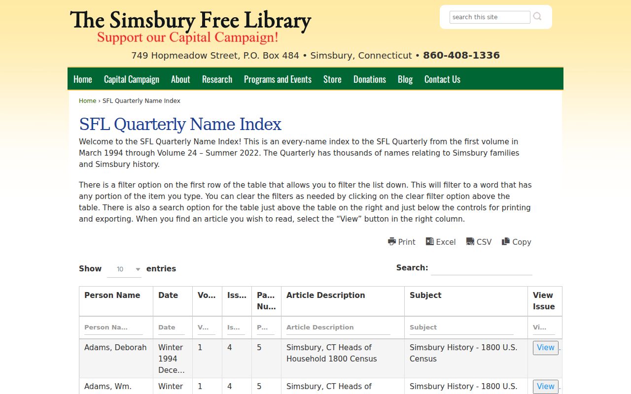
The index is most useful when the issue page is cited beside the deed or directory year that prompted the search.
Simsbury Previous Residents House History
The Historical Resources Inventory at the Simsbury Public Library has fields for name, location, ownership, use, construction, style, integrity, and significance. It is a house-history source, not a current household roster. The official inventory cites Sanborn maps for Simsbury in 1923 and 1940. Those maps can show a footprint, building use, nearby streets, and structure context. They help test whether a historic address belongs to the same property as a present parcel before a name is carried across time.
A house-history file gains strength when its address, structure, deed description, and printed source agree. Keep a note when a map shows only the building and not the people. Compare the old map with the Historic/Architectural Inventory, the Town Clerk's legal description, and the Assessor or GIS parcel. A house may remain while its number, road name, postal label, or surrounding lot pattern changes.
The Simsbury Historical Resources Inventory provides the local search and detail fields used to connect a building record with an address history.
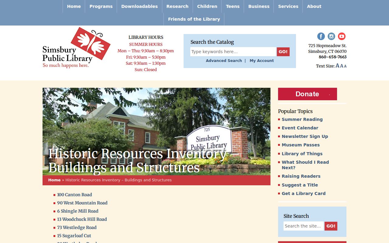
Inventory fields can anchor a house story, but title and people claims still need the deed, directory, census, or newspaper source that supports them.
Simsbury Past Resident Census Context
The National Archives census guide covers federal schedules from 1790 through 1950 and explains the 72-year rule. The 1950 census is the latest released schedule in that series. The Simsbury Free Library's Connecticut 1930 census microfilm is a practical local access point. Census pages group people by enumeration area and household, not always by the street format used in a directory. Use the address, village label, names, ages, relationships, and nearby households together, then record the page or image reference.
The National Archives census research guide gives the federal coverage and release rule relevant to a past-household search.
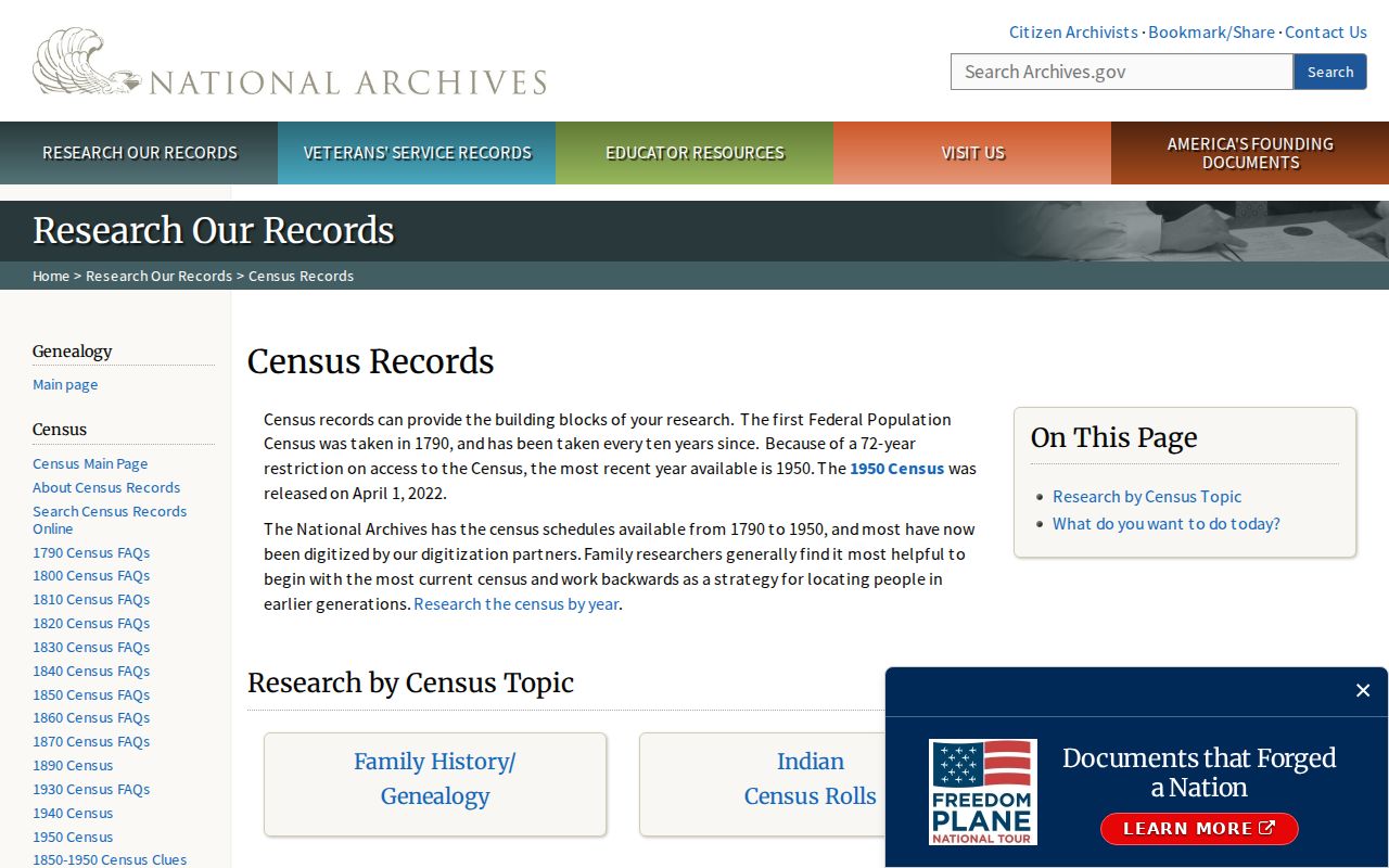
Census evidence can fill a gap between printed directory years, but it should be paired with a local address source before two households are treated as the same.
Naturalization records are a separate identity layer. The National Archives says there is no central index. Before September 27, 1906, local and federal courts could naturalize; later Connecticut federal-court material routes through NARA Boston. A request should include name variants, birth or entry information, naturalization date, residence, and origin when known.
The National Archives naturalization guide explains the custody split and the details that make a request findable.
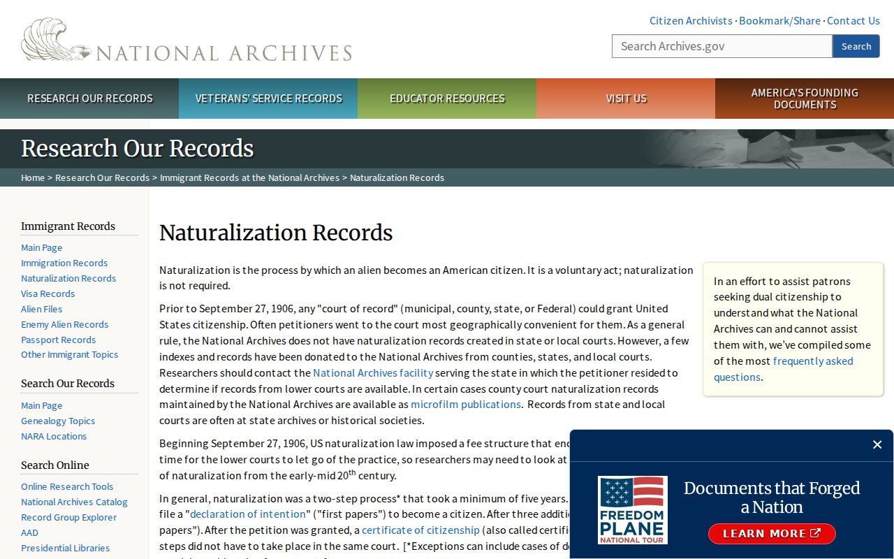
Naturalization can support identity or a date, but it does not by itself establish a household at a particular Simsbury address.
Tracing Simsbury Previous Residents
The address-to-household process works as a chain of dated checks. Start with a current parcel and move to the legal description. Then bridge backward through maps, directory citations, census schedules, and local notices. The path can be written as: address -> Assessor/GIS parcel -> deed legal description -> source-era label -> directory or Sanborn context -> census household -> obituary or newspaper corroboration. Each arrow is a handoff, not a claim that the sources are interchangeable.
- Fix the address as written and note the legal municipality, postal label, ZIP, MBL, and source date.
- Use the Assessor and GIS only to locate the parcel, then confirm title through the Town Clerk and RECORDhub.
- Search the separate directory years and compare the street form with the 1923 or 1940 Sanborn context when applicable.
- Pair a directory point with the nearest census schedule, using the National Archives coverage and the Free Library's 1930 microfilm route.
- Use the Free Library indexes, local papers, cemetery material, or Historical Society archive to test the person's identity and dates.
When a person disappears, list the possibilities without choosing one from silence. The volume may be missing, the person may use an initial, the address may have changed, the household may have moved, or the source may omit that kind of entry. Simsbury previous residents are best documented with a dated source ladder, not a single label.
Lawful house history. A past-address project is appropriate for genealogy, a family archive, or property history. Keep the result to the minimum needed, do not combine records into a dossier about a living person, and never use names or addresses to stalk, harass, or track anyone.
Simsbury's Burned Records Story
Simsbury's earliest gaps have a documented preservation history. The town says records covering the first ten years were accidentally burned in 1680. The historic-district handbook describes a March 26, 1676 attack in East Weatogue that destroyed about 40 dwellings, barns, and outbuildings. An early absence can therefore reflect loss, fire, relocation, or later custody limits. It should not be rewritten as proof that no household or structure existed.
The town was established in 1670, and the history uses settlement names such as Terry's Plain, Hop Meadow, Hoskin's Station, Weatogue, and East Weatogue. By 1710, the handbook describes about 50 houses along both sides of the river. Those place clues can matter when a record predates a modern street number. Mark the gap, preserve the source-era wording, and ask the Town Clerk, libraries, or Historical Society for a surviving alternate record.
Gap rule: No verified continuous local criss-cross run, public historical permit-result index, live deed sample, or official ZIP realignment history was located. Those limits belong in the research record rather than being filled with guessed continuity.